Summits on the Air (a/k/a SOTA) is a program started in the UK that combines hiking and operating ham radio. Most, but not all "activators" operate QRP, but it's not required - it just depends on whether or not the op wants to lug around enough battery power to operate QRO!
When I started operating exclusively QRP last year, there was a lot of talk in the QRP forums about SOTA - the program has been around for 10 years, but only in the past couple years or so has it started taking off in the US. Each area is represented by an "Association", and until 10/1/2012, my home state of Georgia did not have a SOTA Association. Thanks to the efforts of Christian, AK4VV, we are now officially part of SOTA and there are 136 summits that qualify under SOTA rules. Having become a QRPer with small radios capable of efficient portable operation, I felt compelled to go mountaintopping - after all, that's really a QRP tradition.
So, in order to celebrate the new Georgia Association (W4G), Christian obtained the special callsign W4G for use the first two weeks of the new Assocation by various groups and individuals.
My plans were to be on Black Rock Mountain (
W4G/NG-027) precisely at 0000Z on 10/1, but the WX did not cooperate - which really suited me, as it would have meant a tear-down and load-out after dark. Black Rock isn't as remote as a lot of places (the main reason I wanted to activate it at 8pm local!), but it still wouldn't be much fun packing up and walking back to the car in the dark.
My alternate was to activate Brasstown Bald (
W4G/NG-001) the next day after work (local, but still the official first day), but again the rains came down pretty heavily and QTA'd that plan. Since I work only an hour or so from Brasstown Bald and it has a short path to the top from the parking lot, I figured I could easily activate it after work one day if I could get away early. Well, Friday, 10/5 I got that chance. I posted an
alert at SotaWatch to let folks know I would be active. My estimated start time was 2100Z, and that is exactly when my first QSO was logged - can't guess any closer than that!
Brasstown Bald is Georgia's highest point, and is under control of the US Forest Service. They have a parking lot about 500' vertically below the summit, where there is ample parking, along with restroom facilities and a store. The charge to park is $3 per person, not per car. The FS also operates a shuttle bus that will take you to the top of Brasstown Bald for $3 per person. Of course, generally taking the shuttle bus to the summit would be frowned upon by SOTA, but some leeway is allowed for folks with mobility issues.
I took the trail. It has been many years since I walked the trail to the summit, and I didn't recall that the trail was asphalt - it may not have been, but it is now! About 4' wide and relatively steep. I did see at least one couple with a baby stroller...I'm glad they were pushing it up hill and not me!
 |
| Historical marker on right |
I'm slow going up hills, but relatively steady, so I eventually reached the summit - the trail is 6/10 mile and gains 500' in elevation. When you break out of the trail to the summit, there is the observation tower just in front of you, with a Georgia historical marker on the right, along with a little open grassy area with a couple benches. Not totally out in the open, which I figured would be a good thing due to the large amount of traffic that goes to the Brasstown Bald summit. So, that is where I decided to operate.
I found a rock and tied it to some cord and tossed it up into a tree maybe 15 or 18 feet up. I then measured out about 30' or so of #26 hookup wire and pulled it up into the tree. The resulting antenna was a low sloper. I fed it to an Elecraft T-1 tuner and a 15' or so counterpoise, which was placed on the ground. Matching was no problem on 40 through 15 meters, but as low as the antenna was, I was concerned it wouldn't work very well. But work it did! I ended up with 24 QSOs, mostly stateside, but a couple DX contacts as well. Best DX by far was VK5CZ, who had to have been worked long path considering the time of day of our QSO. This was all using a Yaesu FT817ND at 5 watts output on CW.
 |
| View from the summit |
Saturday, I planned to do two summits: Black Mountain (
W4G/NG-022) and Big Cedar Mountain (
W4G/NG-023), as they are accessed from the same trailhead. Unfortunately, I got a later start than I wanted, and ended up in a small town having a fall festival and getting ready for a parade, so my progress slowed to a crawl. Luckily, since I knew I was running late, I had revised my ETA, and hit the revised time to the minute.
First up was Black Mountain: this peak is accessed by an old Forest Service road just north of the Woody Gap parking lot maintained for the Appalachian Trail. Black Mountain isn't on the AT, but is a short side trip. The "trail" is about a mile or so, and gains 600' of elevation. The FS road
is the trail! It initially starts out wooded, but after a sharp left turn, as the elevation starts to rise, the road is joined by a power line, which has a large right-of-way opened up. So most of the hike up is basically walking on an exposed gravel road - not a shaded mountain trail. The gravel is fairly large, averaging 1 two 2 inches. The loose gravel didn't make the climb easy, and it made the descent a real pain because the rocks moved a lot underfoot. But, that doesn't matter much, as the summit itself is great! There is a fire tower - the gate was open when I was there, but don't count on that. There is also a large rock formation, which made for some nice open views in several directions. I decided to operate back from the summit at the edge of an opening so I could use the trees for an antenna support.
The 30' wire sloper worked so well at Brasstown Bald, I put it back up on Black Mountain...with similar results: 29 QSOs including several DX stations. The day was nearly perfect - saw no one else on the trail at all, there was a nice breeze blowing, with the leaves rustling. Due to my late start however, I decided not to activate Big Cedar, as I didn't want to be rushed on the summit, and I needed to get home to take care of our dog, as Mrs. AA4GA was out of town. I figure the mountain isn't going anywhere, I'll get another shot at it!
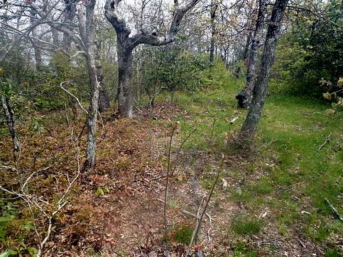 |
| The actual summit |
Sunday I had decided to activate Wildcat Mountain (
W4G/NG-020), and to do so using the special W4G callsign. Wildcat is accessed off the Appalachian Trail from the Hogpen Gap parking area. Just a couple miles up the AT, a trail splits off to the left that goes to the Whitley Gap shelter. Total distance from the parking lot to the summit is about a mile or so, and only 300' of elevation gain. This was a pleasant walk, with a nice rhododendron tunnel on the Whitley Gap trail. Just below the summit (well inside the activation zone) there are some rock formations with views, although it's not as open as Black Mountain. The summit itself is mostly wooded, with a slight opening, and this is where I set up my station. I did get a little spooked, as I had to step over a couple piles of relatively fresh bear poop when I put up the antenna!
Because it was a little crowded, I didn't have room to fully deploy the 30' sloper, so the antenna had a couple bends in it. No problem apparently, as I was able to make 27 QSOs, again including several DX stations. I was planning on staying a little longer than I did, but because I was already a little on edge looking for Smoky Bear and I heard some thunder in the distance, I decided it was time to head home.
I learned a good bit this weekend, and discovered that I have a pretty good system for deploying my antennas and setup and take-down. It only takes 10 to 15 minutes from start to CQ, which I'm happy with. Packing up is even quicker, as I don't have to choose an antenna location! I still haven't figured out yet what to do on treeless summits, but I'm sure I'll come up with something.
A fun three days and end to the first week of the Georgia Association - thanks to everyone for all the QSOs. I probably won't try to activate 3 or 4 summits in one weekend again, but I do hope to go out several more times during the nice fall WX!
You may have noticed that I didn't have any of my own photos and had to reference some others I found on the www - Mrs. AA4GA had the camera with her - I don't know why I didn't think to use my phone! Anyway, originals, with more info about the areas are at
summitpost.org and
ellijaygeorgiacabins.com.


